ACTIVE OUTDOORS: Cloud cover fails to put brakes on bike trip to Munros of Bidein a’ Choire Sheasgaich and Lurg Mhor
Register for free to read more of the latest local news. It's easy and will only take a moment.

Situated in a huge expanse of mountainous terrain stretching from Strathglass in the east to Loch Carron in the west, the Munro of Lurg Mhor is considered one of the most remote.
The Scottish Mountaineering Council guidebook advises leaving it, along with its close neighbour Bidein a’ Choire Sheasgaich, for a fine day to appreciate the panoramic views after the effort of reaching the top.
Perhaps we’re spoilt being so close to such wonderful country here in the Highlands, or perhaps I just like to ignore sensible advice sometimes. Either way, the weekend I had earmarked to climb these two hills didn’t look great weatherwise.
It did make me alter my original plan of heading to the bothy at Bendronaig the night before – a tough cycle in pouring rain didn’t appeal that much for a Saturday night.
That turned out to be a wise decision, when we rode past on the Sunday morning, observing a large collection of mountain bikes propped up against the bothy’s walls and the chimney still sending out poofs of smoke into the cold morning air.
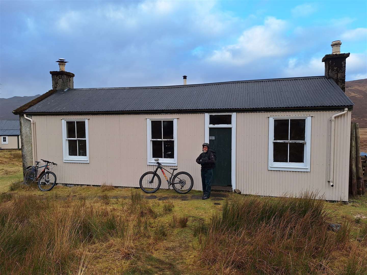
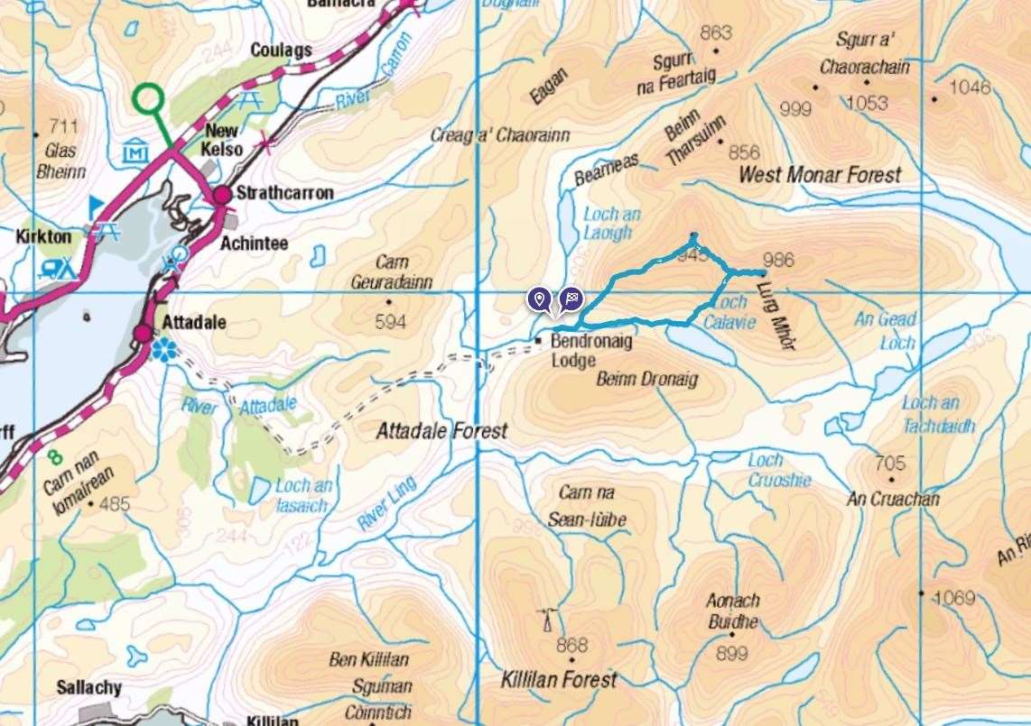
The bothy here is provided for walkers and other travellers by Attadale Estate, which seems to keep the shelter well stocked with wood to burn. The bothy has a sink and a toilet – though no water on tap, of course. The flush is operated by filling a bucket from the nearby burn.
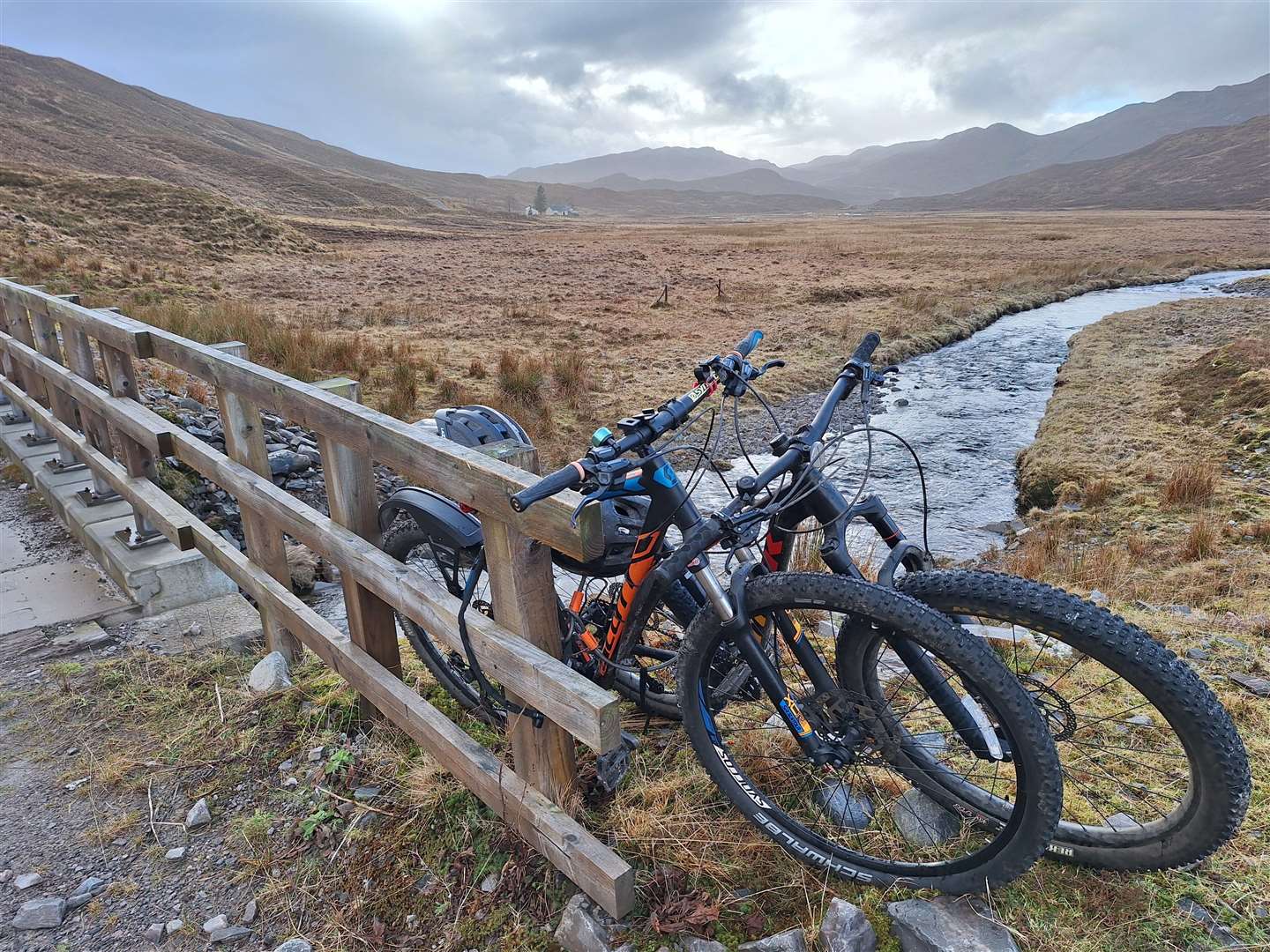
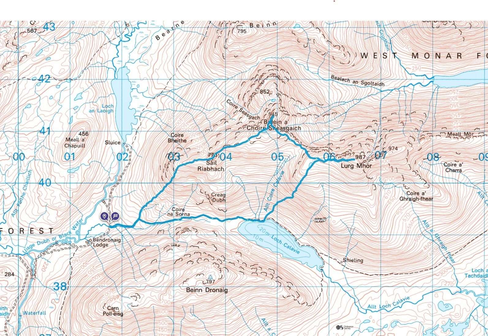
It’s well situated for accessing these two Munros, but with a mountain bike and a lot of energy and determination, you can cycle the eight miles to the bridge just beyond the bothy, climb both hills and cycle out on the same day.
Parking is also provided by the estate, with a car park for walkers beside the entrance to Attadale Gardens, just south of Strathcarron. There’s a railway station here, but you won’t manage to fit the full expedition in a single day if you use the train from Inverness or anywhere along the Kyle line.
I met Allan at the car park, having driven through torrential downpours just a couple of miles back along the road. The mountain forecast had suggested the chances of cloud-free Munros as being “almost nil”. Our expectations were pretty low as we set off on the bikes past the entrance to the gardens and out on the estate track.
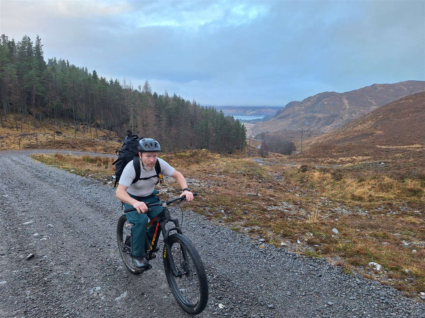
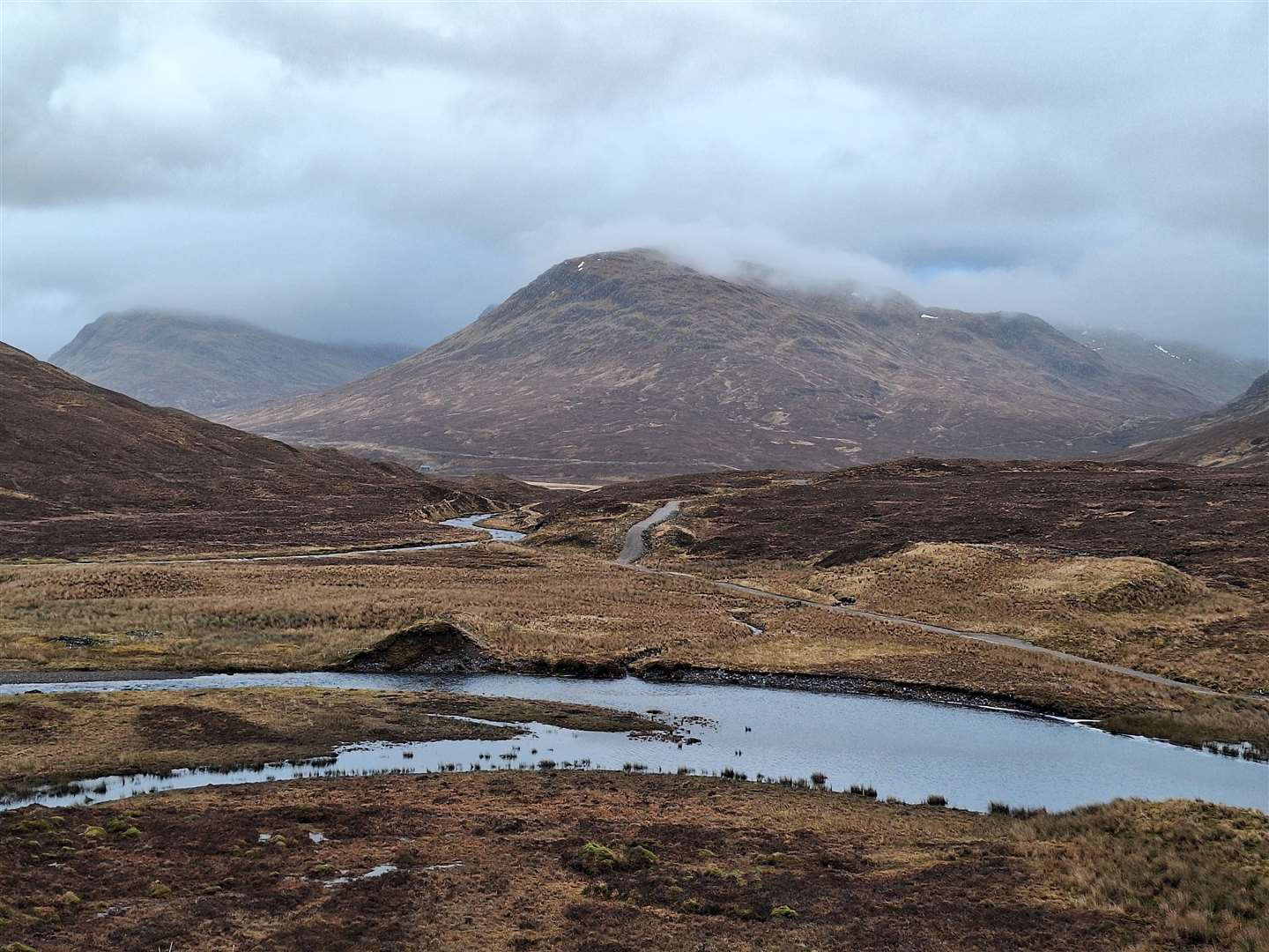
After crossing the river, it climbs – oh boy, does it climb! – up to Loch an Drioghinn then higher still, past dramatic gorges with gnarly old trees surviving in their depths. Eventually you reach a bealach and then a long downhill towards the Uisge Dubh, crossing the water at a beautiful little gorge surrounded by lichen-covered trees.
Soon we passed the lodge and bothy, leaving our bikes at a bridge a short way beyond. My front brake had been playing up a little on the way, and I made the mistake of fiddling too much, which wasn’t a wise idea eight miles from the nearest road. I managed to drain the brake fluid, leaving myself with no front brake for the return journey which would include some seriously steep descents that I had just pedalled up!
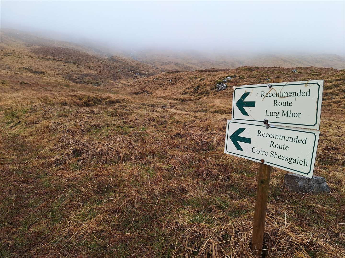
At nearly 250m above sea level, we were almost in the cloud base already. The walk follows an older track off to the right immediately after the bridge – passing a rather decrepit footbridge – but soon leaves the track at a 90-degree turn to the right just before a burn.
Here, we started to make our way up the soggy slope initially alongside the burn then, higher up, following an ill-defined spur to reach to west ridge of Sail Riabhach.
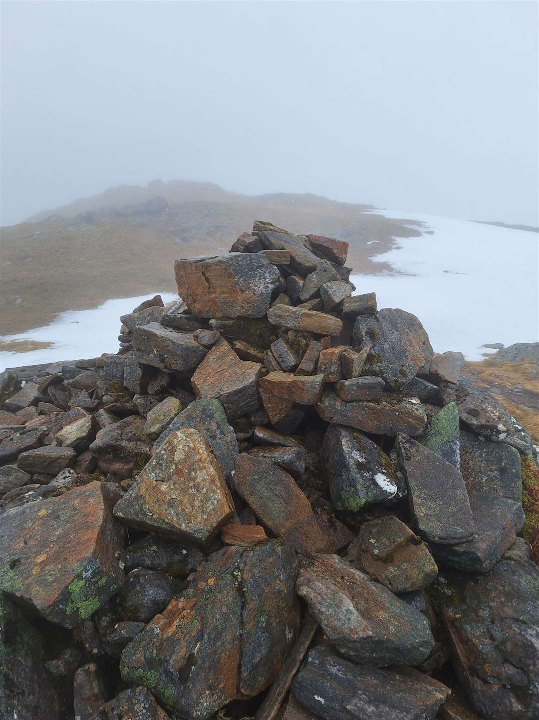
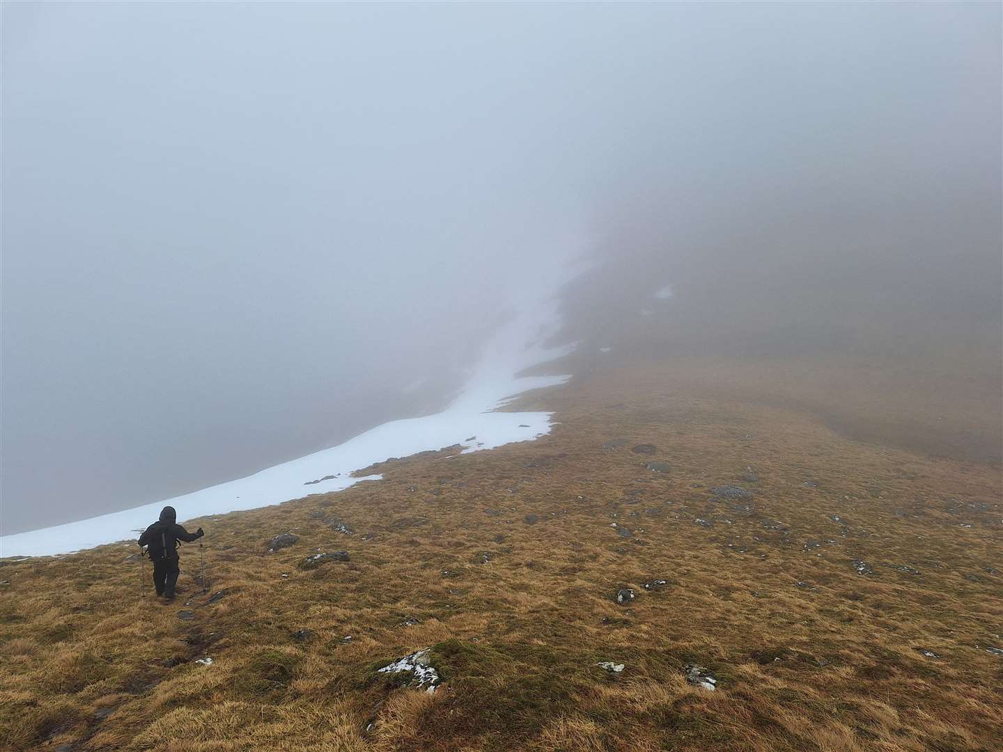
As predicted, there was very little to see, save from some patchy remnants of snow that served to make the navigation that little bit trickier. However, now on the ridge beyond the 773m top, we were soon at the final steep ascent to the summit of Bidein a’ Choire Sheasgaich.
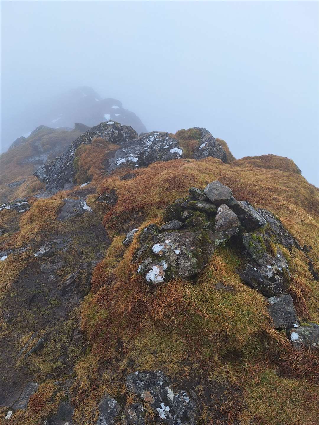
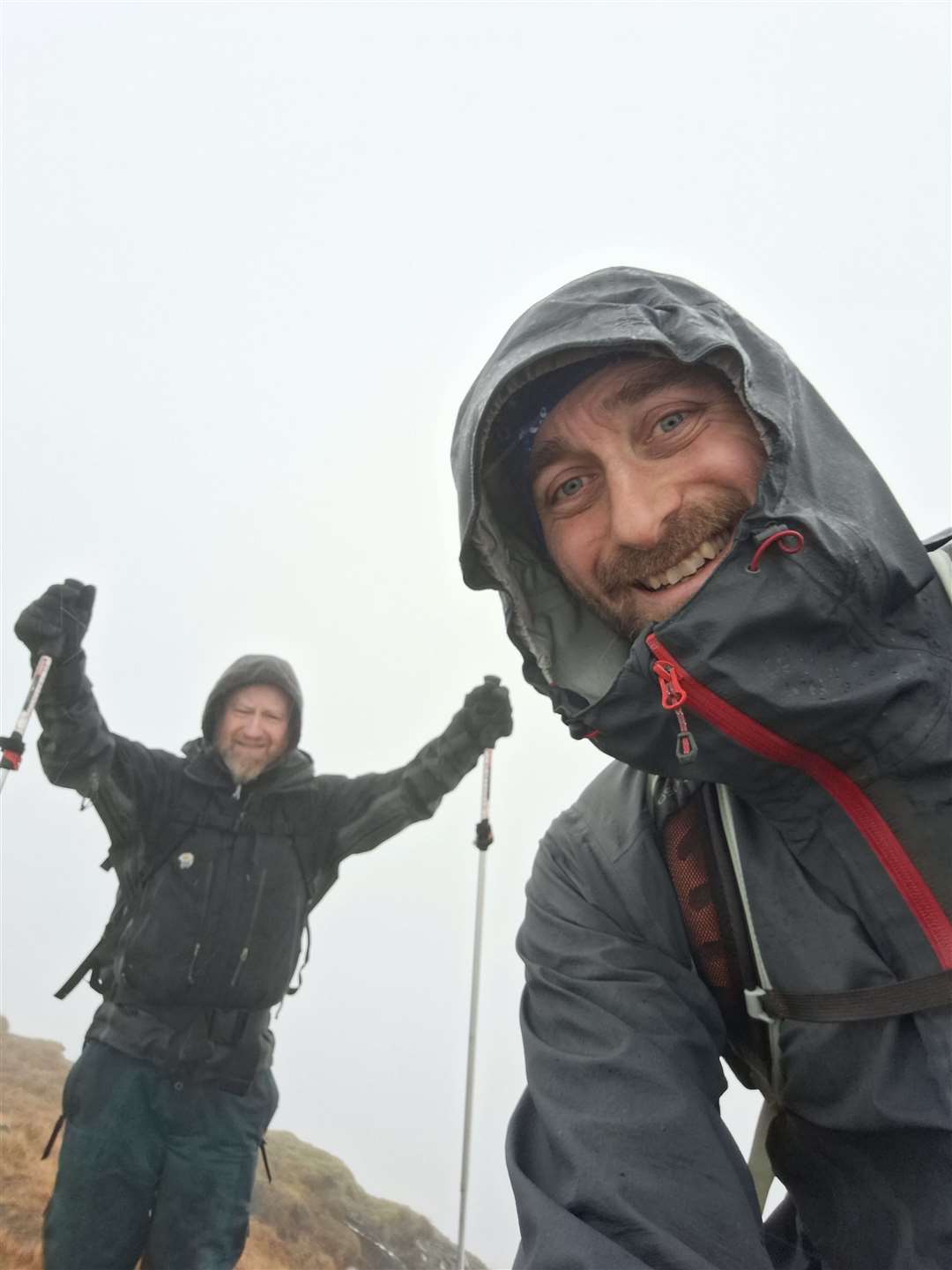
We landed there so suddenly that we weren’t sure initially if the tiny cairn was the true summit, but just a few steps past it was clear that the ground was heading down the other side. Back we went, retracing our steps a short way past the summit – an important bit of navigation here if you don’t want to end up on the wrong side of the hill completely – before heading south-east down a broad ridge to the bealach.
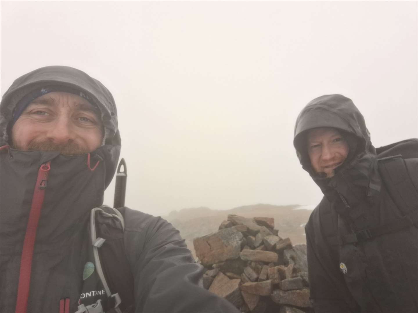
A straightforward ascent of the west ridge of Lurg Mhor took us to the larger cairn there, but alas no views were to be had. We knew that would be the case and, given the conditions, we were pleased to have reached both these Munros.
Now my mind turned to the descent and that long return by bike – with no front brake.
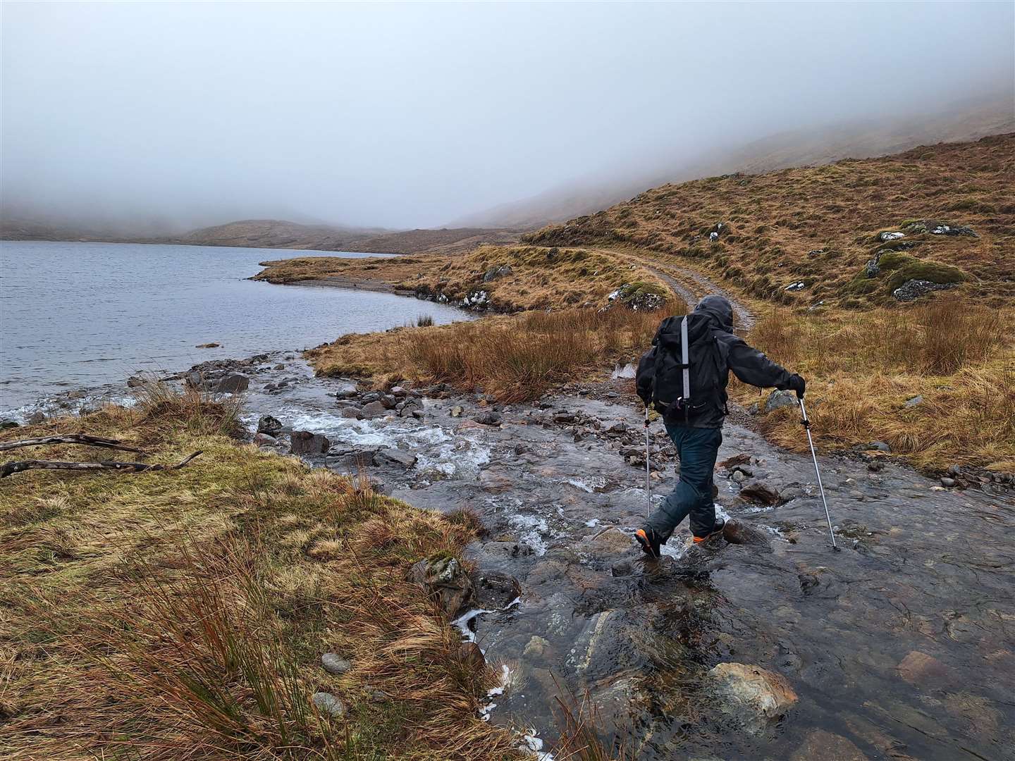
We headed back down the ridge the way we’d come. A path of sorts apparently descends from the bealach on the west side of the Allt Coire Calavie, but we cut off beside a lochan a little higher up the ridge, making our way down the steep pathless slope towards Loch Calavie below.
Descending through the cloud on this complex slope, it was a relief when we could actually make out the edge of this large body of water below us. Eventually the gradient eased and we reached the old track beside the loch, turning west to cross the Allt Coire Calavie on the way back.
There was still three kilometres or so on foot along the track but the going was much easier now, and back at the bikes we enjoyed a rest and some refreshments, as well as a change into a dry top for the cycle back.
We paid a short visit to the now-empty bothy on the way past. It would have been nice to light the fire and put our feet up after an already exhausting day, but we still had that eight miles back to the car park.
I’d prepared myself mentally to walk down some of the steep descents, but much of the initial part of the route was flat to uphill, so Allan and I cycled together and chatted as the cloud behind us started to lift a little – though not completely.
Allan flew down the first steep section, while I gingerly tested controlling my speed using only the back brake. I felt in control, although a little tense in my left hand! But after that I was happy to ride the whole route – and we were back at the cars in no time.
These two Munros were new to me this time, but hopefully I’ll return to see those spectacular views, and perhaps enjoy a night in the bothy, on a future trip to this spectacular part of the Highlands.
Route details
Bidein a' Choire Sheasgaich and Lurg Mhor
Distance 8 miles / 12.5km hike, plus 8 mile / 12.5km cycle each way
Terrain Very steep tracks on cycle, mountain terrain in remote area, navigation and hill skills required
Start/finish Attadale Gardens walkers’ car park
Map OS Landranger 25; OS Explorer 429; Harvey Loch Monar Ultramap
An ascent of two remote Munros from Bendronaig after an eight-mile cycle in on steep tracks from Attadale
Click here to see the route in OS Maps